Questioning Settler Frames of Reference

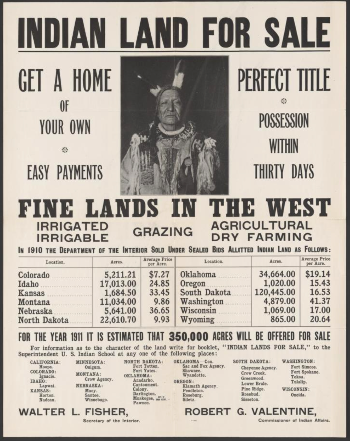
"1689: Population of Albany County is 2,016 comprised of 662 men. 340 women and 1014 children. Indians in the county total 2,800: 270 Mohawks, 180 Oneidas, five hundred Onondagas, 300 Cayugas, 1,300 Senecas, and 250 River Indians. "(https://history.nycourts.gov/wp-content/uploads/2022/02/County-Legal-History_Albany-min.pdf?)
Judge Duggan cites these census figures in his timeline of Albany county. At first glance, the description looks commendable for including named native groups instead of lumping them together.
But its phrasing implies a particular point of view about who people are. If you're a white settler descendant, you might not notice these two lines centering who counts as "the population." The population refers to 2,016 white men, women, and children—not even half of people here. Natives in fact outnumber "the population," but aren't included in a population total. Just an editing problem? I don't think so.
I'm not ascribing exclusionary intentions to Duggan. When he describes the Van Rensselaer "purchase" of Albany lands from the Mahikans, Duggan respectfully clarifies cultural differences between views about land (though again, the "our" makes clear who the reader is supposed to be):
"It should be noted that native Americans did not conceive of a legal ability to buy and sell land. For them, a land sale was merely an agreement to share and equitably use the available resources. It was closer to our concept of a license or easement."
Duggan's census wording strikes me as an example of how, consciously or not, white people consider their perspective predominant. For most of my lifetime, U.S. history has been presented from a white viewpoint, as if objective, universal.
As a member of the centered group, I've found it takes effort to bring into my awareness that which has been occluded. It requires consciousness of a lack. And some understanding of the reasons behind what's been overlooked, distorted, or hidden away completely.
My Finding Throughlines research has revealed how miseducated I've been about native existence in this country. I grew up with the mistaken notion that indigenous populations were historically comprised only of small, scattered groups, made even smaller by European diseases. Diseases that could also be blamed on other empires, like the Dutch, French, and Spanish.
As a schoolkid, I couldn't have named a fraction of the many diverse tribes, or identified their homelands. These maps date from the late sixties and seventies, but I'm sure I never saw them. If I had, they probably would have been presented as records of "vanishing" people, receding into the past.
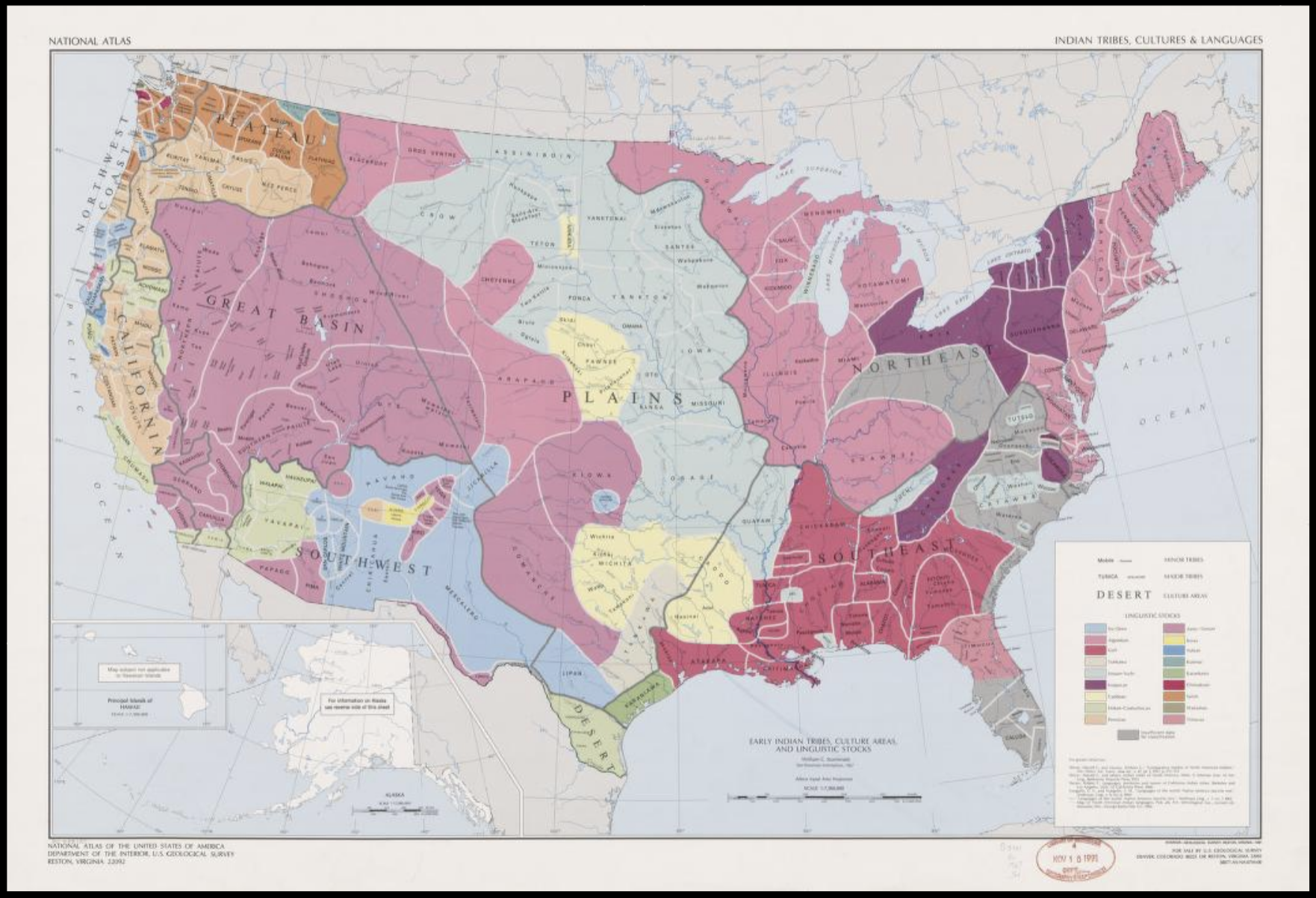
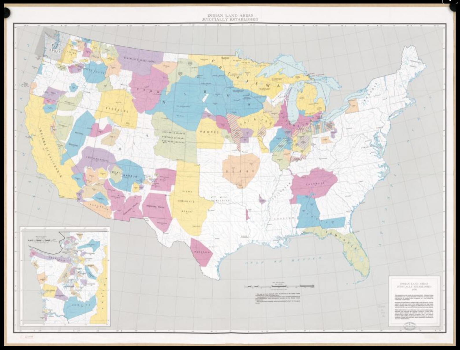
Left: Sturtevant, William C, and U.S Geological Survey. National atlas. Indian tribes, cultures & languages: United States, 1967. Library of Congress, <www.loc.gov/item/95682185/>. Right: Geological Survey, U.S, and United States Indian Claims Commission. Map of Indian Land Areas Judicially Established, 1978. LOC, <www.loc.gov/item/80695449/>.
American culture requires these notions, to support the myth of national progress. Consider these two maps of Iowa made six years apart, roughly a century before I was born. The one on the left shows the orderly grid of "civilization" stretching halfway across the state. Meanwhile, the northwest appears to explode into Indian Territory.
In a matter of years, a ruled line defines the Iowa-Minnesota border. The counties are stacked in tidy rows. Order has supposedly been asserted.
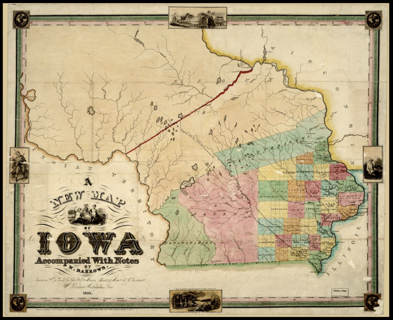
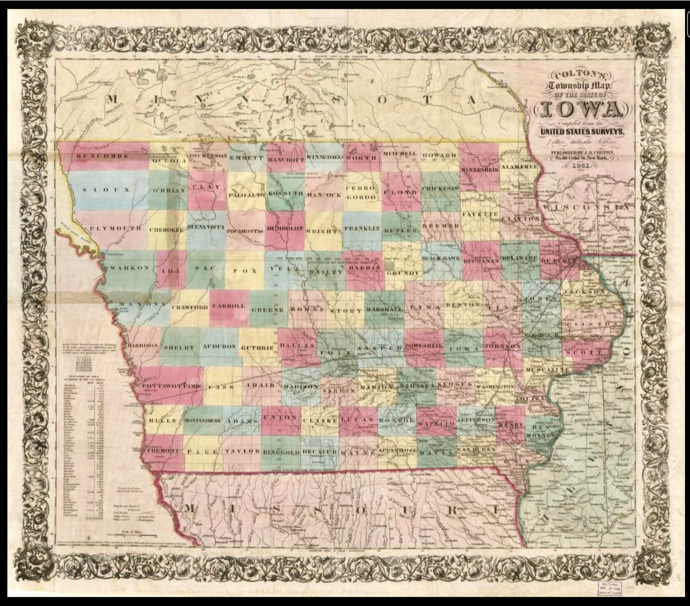
Left: "A new map of Iowa." 1845. Library of Congress, <www.loc.gov/item/2007626856/>. Right: Colton's township map of the State of Iowa. 1851. Library of Congress, <www.loc.gov/item/2018588055/>.
Yet as we know from my earlier post—in which the Dutch arrive in Iowa in 1847, only to find that the Sac and Fox had not entirely been ejected—things were not so neat and definite. The dispossession process created untold suffering and trauma.
This thumbnail of the 1851 map shows Pella in Marion county on the lower right. Tama, where the Sac and Fox, or Meskwaki, managed to buy their own land, is two rows up to the right.
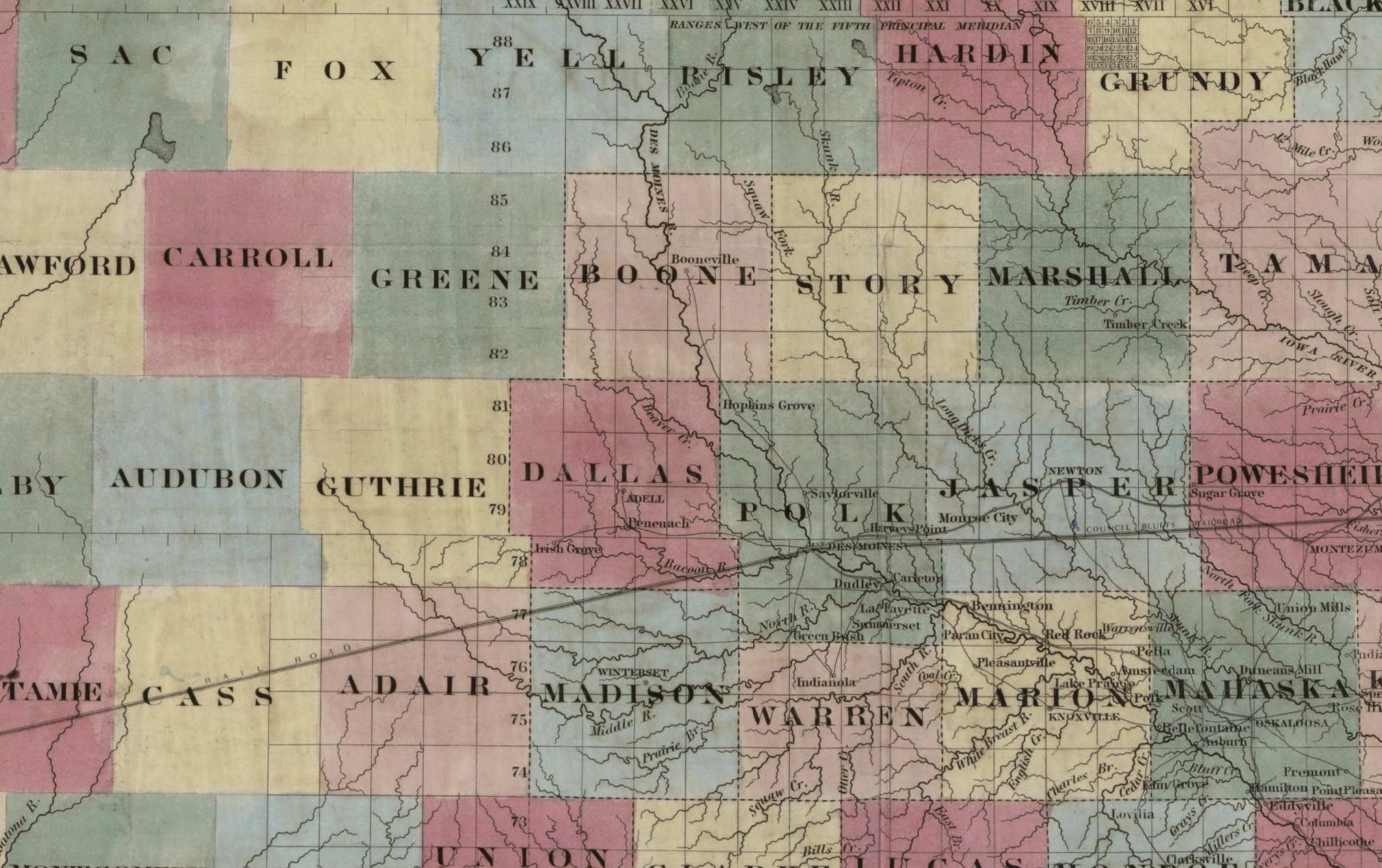
I'm not sure why two northwest counties bear Sac and Fox names. Many others also have names associated with natives: Mahaska, Keokuk, Wapello, Appanoose, Powesheik, and Pottawottamie. When we studied county maps in school, these names meant as little to me as ancient relics.
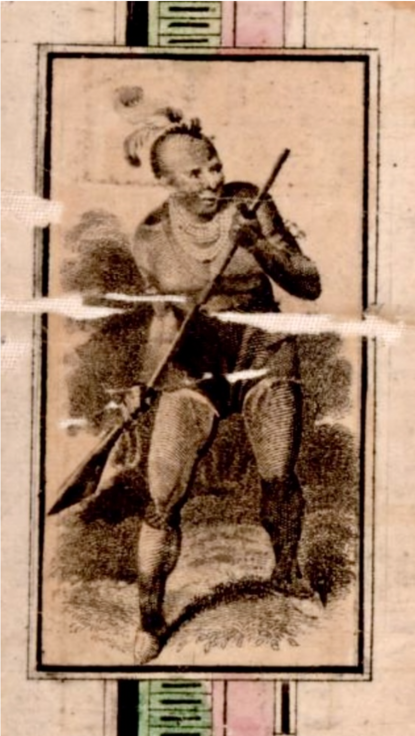
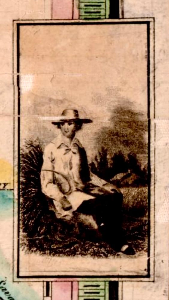
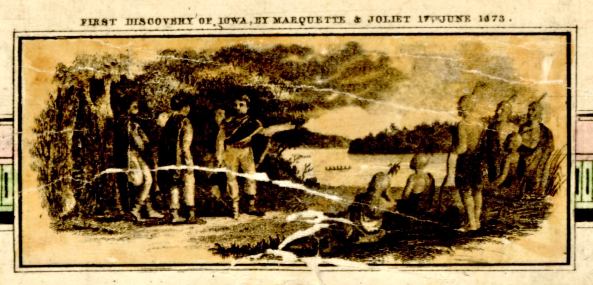
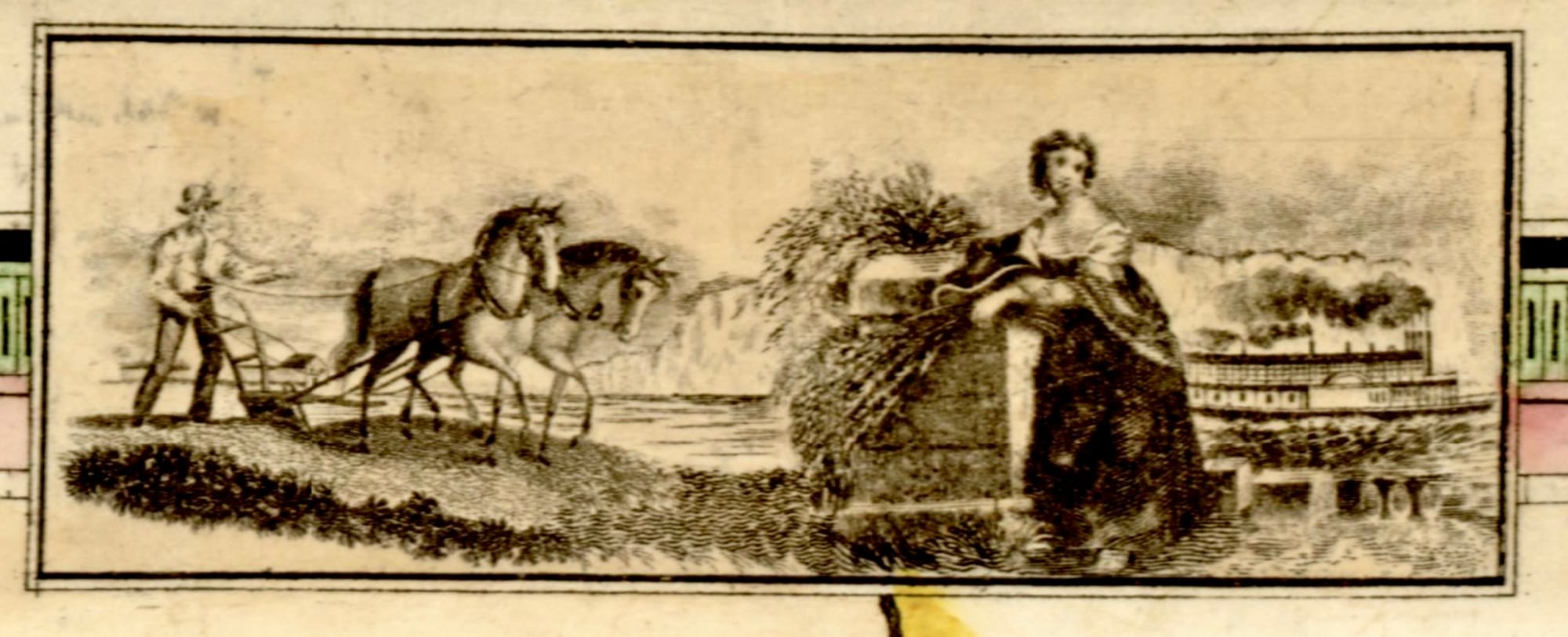
The images decorating the 1845 map's borders tell the stories children are intended to take away. The native with the gun on the western border was supplanted by the settler with the scythe on the eastern border. According to images on the top and bottom, here's how it all went: Marquette and Joliet discovered Iowa in 1673. Some be-feathered natives just happened to be lounging by the river.
Then civilization occurred: white men in top hats plowed the fields, so well-dressed white women could lean on walls holding wheat, while steamships ply the rivers. And white kids could sit in schoolrooms with the flag and the clock on the front wall, standing to pledge allegiance to the best country in the world.
I'm not convinced this perspective is safely behind us.
Which brings me back to a couple of topics raised in this previous post. First, the role of institutions like the National Archives in conserving and interpreting history.
 Ruth Ann Smalley
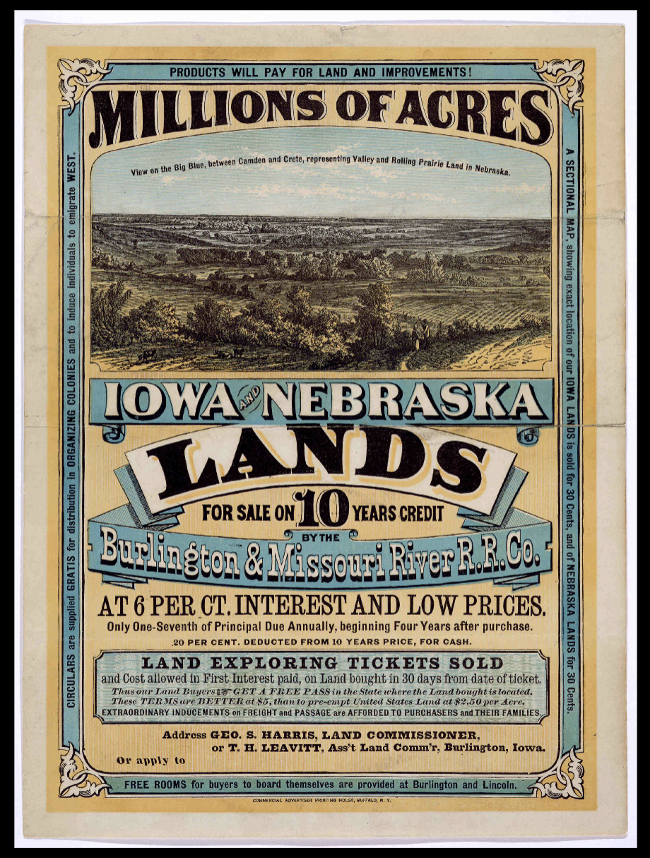
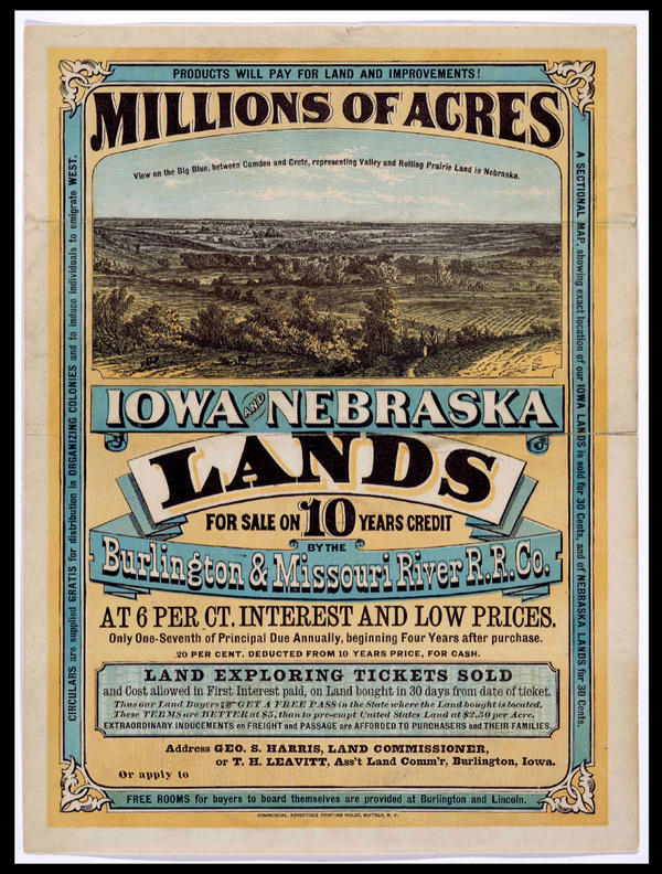
Second, the government's role as real estate agent for Indian lands.
History Class
While researching the Homestead Act at the National Archives website, I saw lesson plans on westward expansion for grades 9-12. One didn't sit well with me.
The discussion text attempted to sound balanced about the motives, situations, and diversity of those involved. But all nuance became strangely reduced in the one sentence description of the activity:
"In this activity, students will use primary sources as historical evidence to determine if western expansion was worth it."
Worth it? How will students be equipped to make such a determination? Will there be a unit taught beforehand, helping students understand what "motivated reasoning" is and how to avoid it?
The instructions assert that "the issues on which conflicts centered were not simplistically two-sided . . . Each group and individual in every conflict was driven by unique priorities and visions. In this activity, students should grasp and grapple with such complexities." (https://docsteach.org/lesson/evaluating-perspectives-on-westward-expansion/)
It isn't clear how they'll manage this. Especially not in the suggested time of forty minutes.
Students are to view primary documents and place them on a scale. Here's where things get even more confusing. In the initial description, they're determining if expansion was "worth it." But in reality, they're simply assigning documents to sides:
"They should evaluate each document and then move it to a position on the scale according to whether it supports the conclusion Expansion was necessary for the nation to grow and prosper, despite the negative impact on Native Americans or The impact on Native American tribes was not worth expansion, and how strongly."
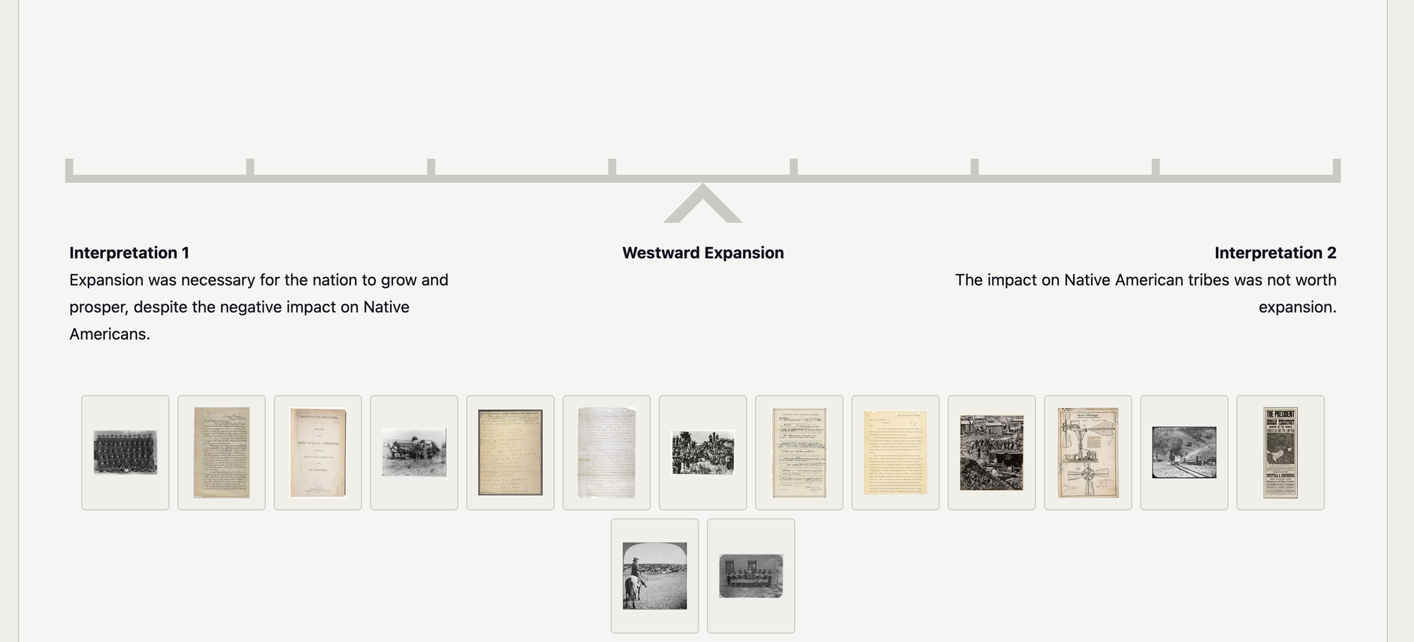
Deciding whether a document is pro or con isn't the same as answering the question raised in the activity description.
Is this the settler framework, continuing to guide teachers in twenty-first century classrooms? Or has this activity been edited to conform with current governmental mandates? To be fair, other related lessons are less problematic.
Compare this lesson with one called Kids at Work: The Child Labor Debate. Same scale activity. But no need to determine whether historic child labor was "worth it."
This time, the terms of the matching exercise are, "Child labor is dangerous and limits children's education. It should be regulated by the federal government," or "Child labor has economic and social benefits. It should not be regulated by the federal government." Students are only asked to categorize, not to arrive at a determination of their own.
The westward expansion activity is profoundly ill-conceived, given the complexity of public land issues, private speculators, the railroad boom, Indian Removal, and the Homestead act of 1862. Not to mention racism, genocide, and fraudulent treaties.
It's the wrong question. And answering it leaves us totally unequipped to create solutions to the many challenges this history has left us with today.
Land Ownership
Political and social conditions created a perfect storm by the 1862 Homestead Act. These two writers take a deep dive into land issues during the years portrayed in The Little House on the Prairie. Kaye tries to imagine an Osage perspective, arguing that Wilder's treatment of the conflict lulls readers into an acceptance of the sadly "vanishing Indian."
Linsenmayer encourages us to consider that not all settlers wished the natives dead, they just preferred them gone. Similar to a lesson offered by the Library of Congress suggesting students imagine being a settler, Lisenmayer seems attached to redeeming a settler viewpoint.
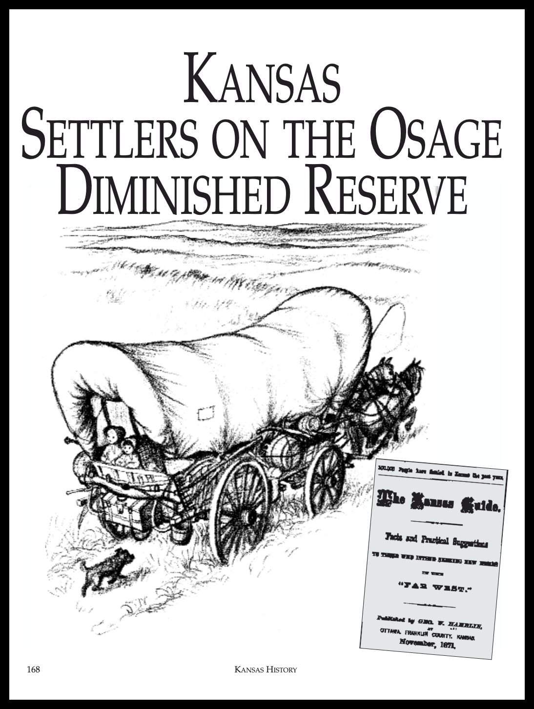
Kaye notes that since Wilder was only 3-4 years old at the time described, her narrative may be unreliable. Her sympathy towards the Osage may be more a product of her adult views, and she gets some facts wrong.
Linsenmayer presents Pa as representative of many illegal settlers like him, whom she feels wanted to get along with their Osage neighbors—not actively hostile, and fearful of provoking hostility. Yes, some settlers risked inciting lethal violence by taking over Osage property, stealing timber, corn, and ponies, and physically abusing or threatening tribal members. But those must be the bad apples, because Pa and others didn't act like that while squatting. Meanwhile, increasing numbers of squatters intruded.
Both writers detail the relentless colonizing forces and lack of choices the Osage faced. Linsenmayer also explains how the government became a realtor:
"following the Civil War, the government entered into several treaties with Indians under which the latter authorized the United States to sell the land in trust for them. . . .the Indians sold their land . . . and the government merely acted as the facilitating middleman. Thus, because the United States did not actually purchase or take title to the ceded lands under these treaties, the lands did not become part of the public domain and were not subject to the preemption and homestead laws. Under this treaty system, large tracts of land passed into the hands of speculators and corporations in contravention of the intent of the preemption and homestead laws."
Congressional machinations meant the Osage had difficulties even entering into these agreements. And of course, their difficulties did not cease when they removed to Indian Country.
For me, the problem now isn't Wilder's book per se. It's that most white readers have been kept clueless about so many important facts.